Atlas 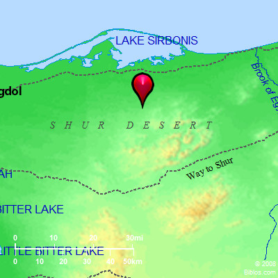 Shur Desert and surrounding area Maps Created using Biblemapper 3.0 Additional data from OpenBible.info You are free to use up to 50 Biblos coprighted maps (small or large) for your website or presentation. Please credit Biblos.com. Occurrences Genesis 16:7 The angel of Yahweh found her by a fountain of water in the wilderness, by the fountain in the way to Shur.Genesis 20:1 Abraham traveled from there toward the land of the South, and lived between Kadesh and Shur. He lived as a foreigner in Gerar. Genesis 25:18 They lived from Havilah to Shur that is before Egypt, as you go toward Assyria. He lived opposite all his relatives. Exodus 15:22 Moses led Israel onward from the Red Sea, and they went out into the wilderness of Shur; and they went three days in the wilderness, and found no water. 1 Samuel 15:7 Saul struck the Amalekites, from Havilah as you go to Shur, that is before Egypt. 1 Samuel 27:8 David and his men went up, and made a raid on the Geshurites, and the Girzites, and the Amalekites; for those nations were the inhabitants of the land, who were of old, as you go to Shur, even to the land of Egypt. Encyclopedia SHURshur, shoor (shur; Sour): The name of a desert East of the Gulf of Suez. The word means a "wall," and may probably refer to the mountain wall of the Tih plateau as visible from the shore plains. In Genesis 16:7 Hagar at Kadesh (`Ain Qadis) (see 16:14) is said to have been "in the way to Shur." Abraham also lived "between Kadesh and Shur" (Genesis 20:1). The position of Shur is defined (Genesis 25:18) as being "opposite Egypt on the way to Assyria." After crossing the Red Sea (Exodus 15:4) the Hebrews entered the desert of Shur (Exodus 15:22), which extended southward a distance of three days' journey. It is again noticed (1 Samuel 15:7) as being opposite Egypt, and (1 Samuel 27:8) as near Egypt. There is thus no doubt of its situation, on the East of the Red Sea, and of the Bitter Lakes. |
    |